By Dominique Tassell
The Bureau of Meteorology (BOM) has shared information regarding the weather expected over the next few days in the Southern Downs.
They stated there is a risk of further heavy localised rain today and overnight.
There is a risk of thunderstorms, which will bring further rain.
They stated much like last night, rain will be localised to the southern end of the region.
Up to 100mm of rain is predicted, “particularly with any storm activity”.
They expected there will be isolated falls with thunderstorms.
While the overall rain prediction is 30mm to 60mm or 70 mm of rain, with storm fronts passing over they will bring localised rain.
Stanthorpe reportedly received 90mm of rain last night and could see another 100mm.
BOM stated that a cumulative total of 200mm is possible, given areas in the southern end of the region have seen 30mm to 60mm across “two hours or so”.
They also stated that 60mm to 80mm is the normal total for the entire month of November.
There is expected to be a “drier airflow” from tomorrow.
The trough will reportedly move further east, with BOM stating that by 9 or so tomorrow morning “the worst will have passed”.
River systems will still be responding, however, and there is a chance of another trough bringing further showers next week.
BOM reported there will still be some showering, and if the ground is already saturated any shower will maintain river levels.
Reportedly, flooding could last well into next week as flood peaks move downstream.
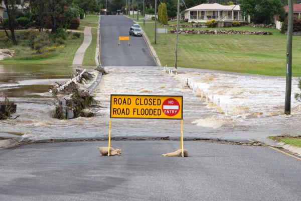
This kind of heavy rainfall over a short period of time can cause dangerous flash flooding, so BOM is urging people to be careful, particularly when they’re out on the roads.
With continued wet weather forecast for the region, Southern Downs Regional Council has urged the community to stay alert.
“Receding water might expose damaged road surfaces so it is important to take care and remember if it is flooded, forget it!”
They have reminded the community to report damaged roads or water over the road via the MySDRC App “as this is the quickest way for council crews to get an accurate picture of the conditions throughout the region”.
Earlier this morning, SDRC reported that Britannia Street, Lock Street, Railway Street, Folkestone Street, and Granite Street in Stanthorpe are closed due to the weather.
Outside the town centre, they reported that the following roads are also closed:
• West Road
• Reid Road
• Bents Road
• Sundown Road
• Accommodation creek crossing
• Dalcouth Road
• Sugarloaf Road
• Kyomba crossing
• Aerodrome Road
• Border Road
• Glenniven Road
• Amosfield Road
• Amiens Road in Thulimbah, Applethorpe, and at Cannon creek crossing
• Elk’s Lane
• Springcreek Road in Greenlands
This information is still correct, with Eukey Road in Stanthorpe, Mount Stirling Road in Glen Aplin, Pine Forest Road in Amiens, and Boatfields Road in Amiens being added to the list.


