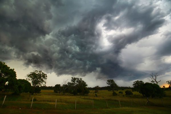
Hit and miss showers and storm

162872_01

SUMMER’S here – as if we didn’t know it this week – and Free Times weather guru TERRY WEST shares his outlook for December – and Christmas Day…
FOR the next few days, we will continue to see some showers and storms but they are hit and miss. This seems to be the pattern the weather will take throughout December with quite a few rain days forecast, but not a lot of rain in them and hit and miss as to where will get it.
December is showing drier than average according to models for 2016, and days and nights will stay warmer than average.
The main driver for this outlook is Southern Annular Mode (also known as SAM).
When SAM is showing a negative, Australia will have more high pressure systems moving through and will reduce the amounts of rainfall we should get.
When this happens in summertime, weather systems are further north than usual, meaning Australia experiences higher pressures than normal.
This is typically associated with reduced rainfall and higher temperatures.
La Nina …
Even though the ENSO (El Nino/Southern Oscillation) is in a neutral Phase, it is starting to swing slightly to a La Nina. This will increase sea surface temperatures in the western Pacific Ocean and may lead to the formation of the first cyclone of the season toward the end of the year.
Over southern and eastern Australia, the cold front events with potential to bring widespread rain are now expected between 12 December to 16 December, 19 December to 23 December and 1 January to 5 January.
In summary …
Storms are expected through December, but may not deliver the rain needed to farmers. Temperatures are likely to be a bit above average and nights will be too.
A fire danger will exist through much of December.
Christmas Day …
At this stage, it looks like Christmas Day maybe partly cloudy during the morning with the cloud clearing to a fine, hot day and a chance of a storm in the afternoon.
Temperatures should range from a Christmas Eve low of around 17c to a high of around 32c.