Snow flurries recorded as Southern Downs freezes through coldest day of the year
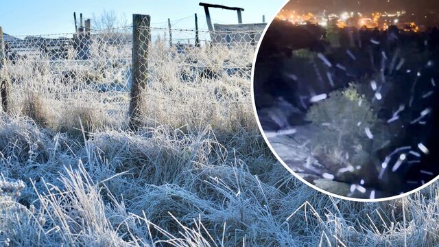
Southern Downs residents froze through the region's coldest day of the year on Wednesday. (Samanthan Wantling/Chris McFerran)

By Jeremy Cook

Light snow flurries and plummeting temperatures capped off the coldest day of the year so far for the Southern Downs.

Bureau of Meteorology data showed temperatures rose to a measly 10.9 degrees in Warwick and just 7.2 degrees in Stanthorpe on Wednesday, 17 July.

Bitterly cold conditions mixed with light showers meant conditions were almost perfect for snow to fall and in some parts it did.

Light snow flurries were captured at Spicers Peak Lodge in Maryvale on Tuesday and another up on Mount Marlay on Wednesday night.

While bigger falls were recorded across the border in northern New South Wales, Bureau of Meteorology senior forecaster Shane Kennedy said the chance for bigger accumulations of snowfall had “probably passed” for the Southern Downs.

“We’re expecting those showers to start to ease off,” Mr Kennedy said.

“It’ll certainly still be cold enough for the next several mornings, but we also need that moisture,” he said.

“We had that the last few days, but [we’re] expecting that moisture will clear off by lunchtime Friday.”

Mr Kennedy said a deep low pressure system had been pushing cold southern air up from the Tasman Sea across Queensland for a number of days, forcing an unusually prolonged cold snap.

“That low pressure area’s been sitting there all week,” he said.

“Normally we just get a blast for a few days and it settles out.”

Weather photographer Chris McFerran was perched up on Mount Marlay for about an hour on Wednesday night hoping to catch a glimpse of snow. For about four minutes in “freezing” temperatures, Mr McFerran said he did.

“It was only a few minutes, it wasn’t much,” he said.

McFerran described the light flurry as “a combination of snow, sleet and rain but probably more sleet than anything”.

“It went on for maybe two or four minutes, something like that, and then it came back to rain,” he said.

“By the time I got up to the top of Mount Marlay, it was down to one degree … the feels like [temperature] was more like probably minus five.”

Mr McFerran had just returned home from snapping light snowfalls in northern New South Wales. He said it was “unfortunate that didn’t happen in Stanthorpe”, likely dashing hopes of those who flocked to the region hoping for a Christmas in July miracle.

“There were people parked in accommodation from Warwick, Stanthorpe right through to Armidale,” he said.

“People are prepared to drive down from extraordinary distances like central Queensland.”

It likely won’t be until late next week when the cold snap ends, forecasters predicted.

Mr Kennedy said windy conditions will likely keep temperatures cold across the region for the next few days, particularly in the mornings.

“That’ll continue for the next few days and should start to change by later next week,” he said.

“We’ll have those winds swing around more to the north and then that’ll bring in much warmer air, relatively speaking.”